Public Transportation in Modern Cities

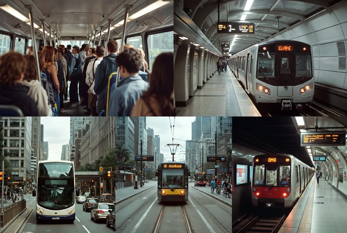
Public transportation remains the vital circulatory system of any thriving metropolis, shaping mobility, economic access, and environmental sustainability. In 2026, how are cities leveraging technology and policy to overcome traditional challenges like congestion, coverage, and user experience? What is the best way for residents and visitors to navigate these evolving systems efficiently and cost-effectively? This guide delves into the core components, innovations, and strategies defining urban transit, offering a blueprint for understanding and optimizing public mobility in the contemporary city.
What Are the Key Pillars of an Effective Public Transportation System?
Why do some city transit networks feel seamless while others are a constant challenge? The difference between success and struggle often lies in mastering several interconnected pillars. First, system coverage and connectivity determine basic access. How many residents live within a 10-minute walk of a frequent service? High-performing networks feature dense, interconnected routes rather than isolated corridors. Second, service frequency and reliability are critical for user trust. A train every 15 minutes is less useful than a bus every 8 minutes that is consistently on time. Real-time tracking has become a non-negotiable expectation by 2026.
Third, fare integration and affordability directly impact equity and usage. Should cities implement flat fares, distance-based pricing, or income-based passes? The trend is toward unified payment systems (via contactless cards or mobile apps) that allow seamless transfers across buses, trams, trains, and even micro-mobility. Fourth, safety, cleanliness, and accessibility (both physical and digital) set the tone for user experience. A system that is not fully accessible to those with disabilities or easy for tourists to navigate fails a fundamental test. Investing in these pillars is the best way for a city to increase ridership and public support.
How to Navigate a City’s Public Transit System Like a Pro?
For new residents or visitors, a complex transit map can be daunting. What is the best way to master an unfamiliar system quickly? Which tools are essential in 2026? Start with official and aggregated mobility apps (like Citymapper or Transit) that provide real-time schedules, multimodal routing (combining metro, bus, scooter, and walk), and service disruption alerts. How can you plan a cost-effective trip? Look for daily or weekly pass caps that automatically apply when using contactless payment, ensuring you never pay more than the pass price.
When should you use different modes? Use high-capacity rail or metro for long, congested corridors during peak hours. Buses and trams are ideal for shorter trips or filling coverage gaps. For the “last mile,” integrated bike-share or e-scooter systems are invaluable. What are the top mistakes to avoid? Not checking for service updates before a journey, assuming payment methods are universal (always have a small cash backup), and traveling at the absolute peak hour if flexible. Learning these nuances is the fastest way to move through a city with confidence.
When Should Cities Prioritize Rail Over Buses or BRT?
The choice between heavy rail, light rail, Bus Rapid Transit (BRT), and standard buses is a major infrastructure decision. What is the difference between these modes in terms of impact and cost? Rail systems (metro, light rail) have higher upfront capital costs but offer greater passenger capacity, superior ride quality, and stronger influence on permanent urban development patterns. They are best for dense, high-demand corridors where demand will remain for decades.
BRT systems, using dedicated lanes and pre-board fare collection, offer “rail-like” service at a lower cost and with more flexibility. How far can BRT go? It is ideal for cities developing key corridors quickly or with lower initial density. Standard buses provide essential flexibility and network coverage but are susceptible to traffic congestion without dedicated lanes. In 2026, the conversation is less about one mode being universally better and more about creating the right integrated hierarchy of services tailored to a corridor’s specific demand, geography, and long-term urban plan.
How Can Technology Solve Public Transportation’s Biggest Pain Points?
Modern pain points—uncertain wait times, complex payments, and poor intermodal connections—are being addressed by smart technology. How is AI and data analytics transforming transit? Agencies use predictive analytics to optimize schedules and fleet deployment based on real-time demand, not just historical patterns. What are the best ways technology improves the user experience? Mobile apps with real-time tracking, account-based ticketing (where your payment method is your ticket), and integrated Mobility-as-a-Service (MaaS) platforms allow planning and payment for all modes in one place.
Which innovations are rising in 2026? Autonomous shuttle pilots are expanding in controlled environments like university campuses or business districts. Electric bus fleets are becoming the standard for new purchases, reducing noise and emissions. Furthermore, Internet of Things (IoT) sensors provide continuous health monitoring of infrastructure, enabling predictive maintenance before a breakdown causes delays. The pros and cons of rapid tech adoption include improved efficiency but also increased cybersecurity risks and a potential digital divide for users without smartphones.
What Are the Top 5 Challenges Facing Public Transportation in 2026?
Even with advanced technology, transit systems face persistent and new hurdles. What should city planners and operators be most concerned about?
-
Funding and Financial Sustainability: Post-pandemic ridership recovery has been uneven. How can systems maintain service levels without stable long-term funding? Diversifying revenue (e.g., value-capture from real estate around stations) is critical.
-
Equity of Access and the “Transit Desert”: Many low-income neighborhoods lack quality service. Ensuring equitable access is a moral and practical imperative for city-wide mobility.
-
Competition from Remote Work and Micro-Mobility: Changed work patterns have altered peak demand, while scooters and ride-hail can fragment trips. Systems must adapt schedules and integrate these modes as feeders, not competitors.
-
Aging Infrastructure and Maintenance Backlogs: Deferring maintenance leads to more costly failures and service degradation.
-
Public Perception and Safety Concerns: Perceptions of safety (both actual and perceived) are a major determinant of ridership. Clean, well-lit stations and a visible staff/security presence are essential.
Addressing these requires a combination of sustained investment, bold policy, and continuous community engagement.
How Does Public Transportation Drive Economic and Environmental Benefits?
Is it worth a city investing billions in its transit network? The data says yes. What are the quantifiable benefits? Economically, transit increases access to jobs, boosts property values near stations, and reduces household transportation costs (often the second-largest household expense). Every dollar invested in public transit can yield up to $5 in economic returns through job creation, increased productivity, and avoided infrastructure costs.
Environmentally, it is a cornerstone of climate action. Transportation is a major source of urban emissions. A full bus can replace 30-40 private cars. Electrifying bus fleets amplifies these benefits. How much can a robust system reduce a city’s carbon footprint? Studies show it can reduce CO2 emissions by millions of metric tons annually. The difference between a car-centric and a transit-oriented city is profound in terms of air quality, public space usage, and overall livability.
How to Design Public Transit for Future-Proof Cities (2026 and Beyond)?
What is the future of urban mobility? The goal is a seamless, equitable, and sustainable system. How can cities design for this future?
-
Integration is Key: Physical, fare, and digital integration across all modes (train, bus, bike, scooter, ride-share).
-
Focus on Housing and Land Use: Transit-oriented development (TOD) that zones for dense, mixed-use neighborhoods around stations.
-
Embrace Flexibility: Use data to create flexible services like on-demand micro-transit in lower-density areas to complement fixed-route networks.
-
Prioritize Resilience: Design systems to withstand climate impacts like flooding or extreme heat.
| Planning Aspect | Traditional Approach (Past) | Future-Proof Approach (2026 Onward) |
|---|---|---|
| Planning Focus | Moving vehicles | Moving people (user-centric design) |
| Technology Role | Siloed systems (scheduling, payment) | Integrated, data-driven MaaS platforms |
| Energy Source | Diesel-dominated fleets | Fully electrified and renewable-powered fleets |
| Infrastructure Goal | Maximum car throughput | Dedicated transit lanes, pedestrian zones, and micro-mobility hubs |
| Success Metric | Ridership numbers alone | Ridership, user satisfaction, equity of access, and emissions reduced |
Frequently Asked Questions (FAQs)
1. What is the single most important feature of a good public transportation system?
While coverage and frequency are fundamental, reliability is arguably the most critical feature in 2026. Users can plan around a predictable schedule, even if it’s less frequent, but unpredictable delays destroy trust and ridership. Real-time accuracy is now expected.
2. How can I find the most cost-effective fare option in a new city?
The best way is to check the transit agency’s website or app for visitor passes or daily/weekly caps. In many modern systems, using the same contactless bank card or phone for every trip will automatically cap your daily spending at the price of a day pass.
3. What’s the difference between a tram, light rail, and a streetcar?
The terms are often used interchangeably, but generally: A streetcar/tram typically shares lanes with traffic, has shorter trains, and makes frequent stops in urban cores. Light Rail Transit (LRT) often has dedicated rights-of-way (sometimes underground or elevated), longer trains, and longer station spacing, functioning as a higher-capacity cross-town service.
4. How safe is public transportation compared to driving?
Statistically, public transit is significantly safer per mile traveled than personal vehicle travel. The key safety considerations for riders are typically personal security (especially at off-peak hours) rather than crash risk. Agencies are increasingly focusing on “security by design” and staff presence to improve perceived safety.
5. Can public transportation really help with traffic congestion?
Yes, decisively. One full rail car or bus can remove dozens to hundreds of cars from the road. However, for maximum impact, transit must be competitive in speed and convenience, which often requires dedicated lanes and priority signaling that protect it from the very congestion it aims to reduce.
6. What is Mobility-as-a-Service (MaaS)?
MaaS is a digital platform that integrates planning, booking, and payment for all forms of transport (public transit, taxi, bike-share, scooter, car-share) into a single, on-demand service. The user can plan a door-to-door trip and pay with one account, choosing based on cost, speed, or preference.
7. How is public transportation adapting to climate change?
Adaptations include: electrifying fleets to reduce emissions, hardening infrastructure against extreme weather (e.g., cooling stations, flood barriers), creating shaded bus stops, and ensuring services can function as critical infrastructure during heatwaves or storms.
Disclaimer: The information provided in this article is for general guidance and informational purposes only. Public transportation systems, fares, routes, and technologies vary greatly by city and are subject to change. The user is solely responsible for verifying current information with local transit authorities before travel.
Keywords: public transportation, city transit guide, how to use public transport, urban mobility solutions, sustainable transportation, bus and train system, navigating city transit, public transit tips, future of transportation, smart city transit